
Tonight lows will dip down into the low 30's. We will see an increase in clouds in the morning before giving way to yet another storm. Sunday will feature rain later in the afternoon and the intensity of that rain will increase as we progress through Sunday Night and Monday. There will be yet another increased period for severe weather and you will see that on the maps that I will post.

I have highlighted a stormy Sunday and then a severe weather outbreak for Monday. If then the middle of the week will give way to sunny skies and some nice temperatures. I do however suspect that another storm will come around Friday of this coming week. I think that storm will probably be the pattern breaker and will give way to the return to winter for a 1-2 week period.

This is the GFS off of the NOAA.gov site and it clearly shows a nice storm for Sunday and Monday.
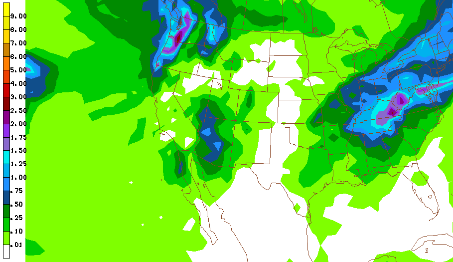
This is the GFS's total precipitation legend for the Sunday-Monday period. It matches my map well.

Here is my Rainfall forecast for Sunday-Monday. This time the heavier precipitation will be over in the eastern part of the Ohio Valley. With the recent heavy rains, this storm will have a greater impact on the Streams, Creeks, and Rivers throughout the area. That meas this period will be outlined for more FLOODING.

This is my map for where I think the Severe Weather will take place for Sunday. This is two pronged storm for severe weather as what is in the west must come EAST!!

This is the Severe Weather MAP for Monday. It's not as intense but still packs a punch.
I'll have another update later in the day on Sunday.
No comments:
Post a Comment