This is VIVALDI'S FOUR SEASONS. IT FITS THE CRITERIA FOR THE CRAZY WEATHER PATTERNS WE'VE BEEN EXPERIENCING
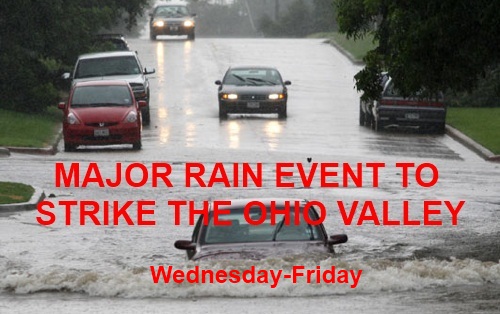
Another MAJOR EVENT is set to strike the Ohio Valley. Streams, Creeks and River are already up and some are past flood stage. This will only create more flooding and dangerous low riding roads that are close to bodies of water. It should be noted that this is the 4TH major rain storm to affect the Ohio Valley area in 2 weeks. Spring has definitely made it's presence known, BUT how long will it LAST?
Lets start with the current and then we will go into a Long Range Forecast Mode for a second.

The GFS at 42HRS out likes a strong storm......this storm will ride from the Southwest into the GREAT LAKES region.

Here is what the GFS is forecasting in terms of TOTAL RAINFALL. I think it's a bit scarce and we will see 2-3" of rain. it's been the common phenomenon of the past two weeks.

This is my RAINFALL FORECAST.
Now onto the LONG RANGE forecast....

The area shaded in BLUE is where winter has it's best chance to return. I do think OLD MAN WINTER will drop another snowstorm on us. It's not out of the question that one could be an ICE storm.....with the temperatures out in the WHACKO WORLD the atmosphere is obviously UNSTABLE.

Areas that are beneath i the I-70 corridor will have the most unstable atmosphere, leading to an increased threat for an ICE storm. Let's clarify, I am not saying that this is going to happen, but it is a possibility.

The areas shaded in orange are the most prone to a MAJOR SNOWSTORM. Right now the WEATHER Pattern is taking major rainstorms through the ohio valley. If that were to continue, it will dump some snow on us before TRUE SPRING begins.
OKAY I'LL HAVE THE RADARS UP AND RUNNING ON THE MAIN PAGE ON WEDNESDAY...BUT DON'T HESITATE TO VISIT THE RADAR PAGE.
No comments:
Post a Comment